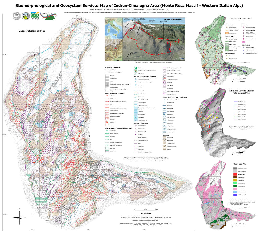
QGIS - Map Symbols
All graphics symbols used in the map legend are based on the "new italian guidelines for geomorphological mapping".
The symbols are created following embedded QGIS format style (.qml) and available "as is" for free, you can use, copy, distribute and improve them, but, you might be kind to cite our work.
Citation:
F. Tognetto, L. Perotti, C. Viani, N. Colombo & M. Giardino (2021) Geomorphology and geosystem services of the Indren-Cimalegna area (Monte Rosa massif – Western Italian Alps), Journal of Maps, 17:2, 161-172, DOI: 10.1080/17445647.2021.1898484.
The package includes styles and instructions.
If you need more information or any help please contact us at:
federico.tognetto@unito.it
If you need more information or any help please contact us at:
federico.tognetto@unito.it